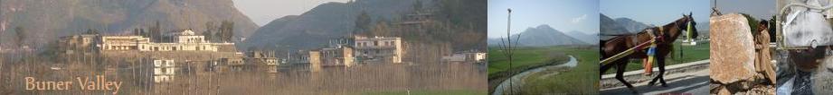
The District for revenue administration is divided into six (6) Tehsils vis-à-vis Gadezai, Daggar, Gagra, Chagharzai,
Chamla, and Totalai. Buner is one of the less developed District of the North West Frontier Province. Less then 40% of the
population has the luxury of electricty. Swari and Pir Baba bazaars are main urban centers. Chinglai, Totalai, Torwarsak,
Joowar, Daggar pul, Daggar Kaley, Kalpanai and Dewana baba also have small Bazars.
| |
Recent Numbers For Buner Valley:
Total Area: 1865 Sq
Km
Total Population: 0.506 MillionPopulation
Density (P/km): 271 Persons
Literacy Ratio: 22.6% (Male 38.20%
and Female 7.7 &)
Agricultural Land:1, 36,880 Acres
Irrigated Land: 37,316 Acres
Rain Fed Land: 99,562
Acres
Area: 1743.67 Sq Km i.e. 4, 25,757 Acres.
Buner
Valley,CENSUS 1998
Both sexs| 501143
Male| 249917
Female| 251226
Density per Sq.Km| 272
Annual Growth Rate(%)| 3.80
|
COMMUNICATION:
Roads | |
Total
| 642 Km |
Black Topped | 346 Km |
Shingled
| 116 Km |
Telephone |
Digital Exchange
| 15 |
No: of Connections
| 10793 |
Pending Claims | 712 |
Swat Population 1998CENSUS
Urbon |
Rural
Both sexes | Male | Female || Both
sexes| Male| Female
SWAT | 174469| 91862 | 82607 || 1075103 |549073
| 526030
Matta |
- | - | - ||
249175 | 125067 | 124108