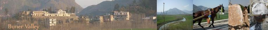
Geography: Buner lies
between 34-9 and 34-43 N latitude and 72-10 and 72-47 E longitude. It is bounded on the North by Swat District, on the West
by Malakand Agency, on the South by Mardan District, and on the East by river Indus and Hazara Division. The region is encircled
by hill on all side and is separated from Swat by a range of mountains. Elevation varies from 1200 ft in Totalai (Khudukhel)
in the South to 9,550 ft of Dosara Peak in the North. The hilly tracks are enriched with mineral which has now become the
vivid symbol of business in the area.
| |
 The area of Buner District is mostly surrounded by big hills which are covered with pine trees. There are three main
rivers namely Barandu, Chamla and Budal and the former flows in the midst of the District. Most of the population is rural
and main source of their livelihood is agriculture. Main crops of the area are wheat, maize, tobacco, and sugarcane. |
Climate: The climate of Buner
varies with the elevation and may be classified as dry sub-tropical. Most part of the year remains pleasant. Moon-Soon rains
during summer while in winter; snowfall on the mountain peaks is also common. During Rabbi crop season people grow crops like
toba cco and wheat and during Kharif maize and sugar-cane. The temperature in summer steadily raises up to 44 C0 and in winter
it gradually drops and goes down to -2 C0. Rainfall throughout the year is 105 CM with un-even distribution. The average annual
rainfall is approximately 30 inches.
cco and wheat and during Kharif maize and sugar-cane. The temperature in summer steadily raises up to 44 C0 and in winter
it gradually drops and goes down to -2 C0. Rainfall throughout the year is 105 CM with un-even distribution. The average annual
rainfall is approximately 30 inches.
Forestry: Total
area covered with the forest is32102 hectares. Buner District falls in the subtropical ecological zone with warm summer and mild winter. Generally Forest is very weak. Main forest types are shrubs
(acacia, kaha sanatha etc) at lower elevation and chir pines at higher elevation. Local people are dependent on this forst
to meet their timber, fuel wood and fodder requirements. About 30 years ago during era of “Wali Swat”, the area
was known for its best forests. Those forests comprised of Chir, Samantha, Olea and Phulai etc. at that time, after merger
of the area with Pakistan, road network was developed and administration control become loose that led to over exploitation
of forest. In addition to that, few locals and non-local an non-local started illegal timber business. Resultantly forest
resources were badly damaged in only two decades. Seasonal Ajars (Nomadic grazers) have also played their role in forest depletion.
With the ever-increasing population pressure locals are forced to think over the situation but no joint effort/decision could
be made in this regard.
subtropical ecological zone with warm summer and mild winter. Generally Forest is very weak. Main forest types are shrubs
(acacia, kaha sanatha etc) at lower elevation and chir pines at higher elevation. Local people are dependent on this forst
to meet their timber, fuel wood and fodder requirements. About 30 years ago during era of “Wali Swat”, the area
was known for its best forests. Those forests comprised of Chir, Samantha, Olea and Phulai etc. at that time, after merger
of the area with Pakistan, road network was developed and administration control become loose that led to over exploitation
of forest. In addition to that, few locals and non-local an non-local started illegal timber business. Resultantly forest
resources were badly damaged in only two decades. Seasonal Ajars (Nomadic grazers) have also played their role in forest depletion.
With the ever-increasing population pressure locals are forced to think over the situation but no joint effort/decision could
be made in this regard.
Agriculture: The
average annual rainfall is approximately 30 inches in the area. Buner is mostly surrounded by high hills, which are densely
covered by pine and other trees. Main crop of the area are  wheat, Maize, Tobacco, sugarcane, barly and pules. Vegetable production is very low. However potato, ladyfinger, pumpkins,
beans, tomato, etc. are grown on small scale. A few types of fruits are also grown in the area such as apricot, mulberry,
fig, plum, walnut, wild-persimmon, and apples etc. 61.7% of the land is cultivable.
wheat, Maize, Tobacco, sugarcane, barly and pules. Vegetable production is very low. However potato, ladyfinger, pumpkins,
beans, tomato, etc. are grown on small scale. A few types of fruits are also grown in the area such as apricot, mulberry,
fig, plum, walnut, wild-persimmon, and apples etc. 61.7% of the land is cultivable.
Buner has a total surface of 172096
hectares out of this 111733 hectares are uncultivable and are classified as forest, pasture or unusable leaving 60,363 hectares
of potentially cultivable land. Various projects which previously operated such as B.D.P. (Buner Development Project)
etc. had constructed lift irrigation schemes and tube-wells which have increased the production of cereal crops but still
the gap between demand and supply could not be bridged.
Do your part!
Add more to the discription above!